
乌玛塘乡 topographic map
Interactive map
Click on the map to display elevation.
About this map
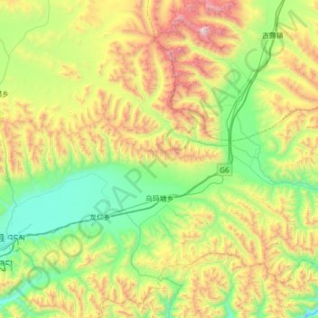
Name: 乌玛塘乡 topographic map, elevation, terrain.
Location: 乌玛塘乡, 当雄县, 拉萨市, 西藏自治区, 中国 (30.41767 91.28762 30.82786 91.89986)
Average elevation: 16,184 ft
Minimum elevation: 13,783 ft
Maximum elevation: 21,447 ft
Other topographic maps
Click on a map to view its topography, its elevation and its terrain.