
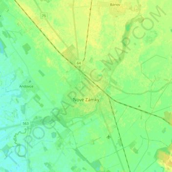
Nové Zámky topographic map
Interactive map
Click on the map to display elevation.
About this map
Name: Nové Zámky topographic map, elevation, terrain.
Average elevation: 381 ft
Minimum elevation: 354 ft
Maximum elevation: 413 ft
The town is located on the Danubian Lowland, on the Nitra River, at an altitude of 119 metres. It is located around 100 km from Bratislava and around 25 km from the Hungarian border. It is a road and railway hub of southern Slovakia.
Other topographic maps
Click on a map to view its topography, its elevation and its terrain.
Rastislavice
Slovakia > Region of Nitra > District of Nové Zámky
Rastislavice, District of Nové Zámky, Region of Nitra, Western Slovakia, 941 08, Slovakia
Average elevation: 410 ft
Strekov
Slovakia > Region of Nitra > District of Nové Zámky
Strekov, District of Nové Zámky, Region of Nitra, Western Slovakia, 941 37, Slovakia
Average elevation: 535 ft
Štúrovo
Slovakia > Region of Nitra > District of Nové Zámky
Štúrovo, District of Nové Zámky, Region of Nitra, Western Slovakia, Slovakia
Average elevation: 377 ft