
Andaray topographic map
Interactive map
Click on the map to display elevation.
About this map
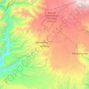
Name: Andaray topographic map, elevation, terrain.
Location: Andaray, Province of Condesuyos, Arequipa, Peru (-16.04136 -73.01733 -15.53477 -72.66070)
Average elevation: 9,311 ft
Minimum elevation: 1,644 ft
Maximum elevation: 21,010 ft