
Thank you for supporting this site ❤️
Make a donation
Make a donation
Gear up for your next adventure:
As an Amazon Associate, this site earns from qualifying purchases at no extra cost to you.
Graus topographic map
Click on the map to display elevation.
Thank you for supporting this site ❤️
Make a donation
Make a donation
Gear up for your next adventure:
As an Amazon Associate, this site earns from qualifying purchases at no extra cost to you.
About this map
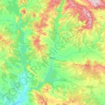
Name: Graus topographic map, elevation, terrain.
Location: Graus, La Ribagorza, Huesca, Aragon, 22430, Spain (42.05759 0.25895 42.35155 0.51567)
Average elevation: 2,329 ft
Minimum elevation: 1,027 ft
Maximum elevation: 5,056 ft
Thank you for supporting this site ❤️
Make a donation
Make a donation
Gear up for your next adventure:
As an Amazon Associate, this site earns from qualifying purchases at no extra cost to you.