
Uster topographic map
Interactive map
Click on the map to display elevation.
About this map
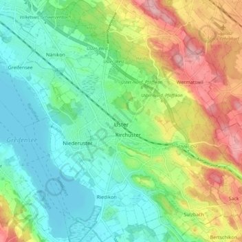
Name: Uster topographic map, elevation, terrain.
Location: Uster, Bezirk Uster, Zúrich, Suiza (47.32015 8.67750 47.38387 8.76042)
Average elevation: 1,598 ft
Minimum elevation: 1,417 ft
Maximum elevation: 1,939 ft