
Thank you for supporting this site ❤️
Make a donation
Make a donation
Gear up for your next adventure:
As an Amazon Associate, this site earns from qualifying purchases at no extra cost to you.
Dutch topographic map
Click on the map to display elevation.
Thank you for supporting this site ❤️
Make a donation
Make a donation
Gear up for your next adventure:
As an Amazon Associate, this site earns from qualifying purchases at no extra cost to you.
About this map
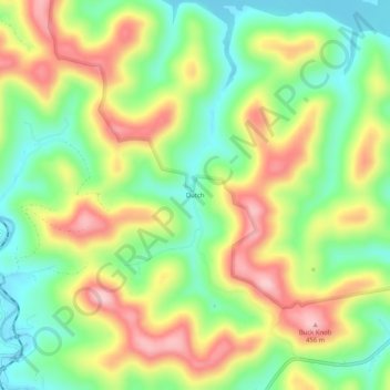
Name: Dutch topographic map, elevation, terrain.
Location: Dutch, Braxton County, West Virginia, 26627, United States (38.78510 -80.63815 38.82510 -80.59815)
Average elevation: 1,076 ft
Minimum elevation: 771 ft
Maximum elevation: 1,463 ft
Braxton County trails, hiking, mountain biking, running and outdoor activities
Thank you for supporting this site ❤️
Make a donation
Make a donation
Gear up for your next adventure:
As an Amazon Associate, this site earns from qualifying purchases at no extra cost to you.