Prettau - Predoi topographic map
Interactive map
Click on the map to display elevation.
About this map
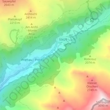
Name: Prettau - Predoi topographic map, elevation, terrain.
Average elevation: 6,598 ft
Minimum elevation: 4,649 ft
Maximum elevation: 9,993 ft

Click on the map to display elevation.
Name: Prettau - Predoi topographic map, elevation, terrain.
Average elevation: 6,598 ft
Minimum elevation: 4,649 ft
Maximum elevation: 9,993 ft