
Waterville topographic map
Interactive map
Click on the map to display elevation.
About this map
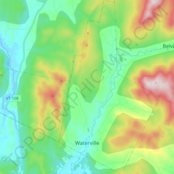
Name: Waterville topographic map, elevation, terrain.
Location: Waterville, Lamoille County, Vermont, 05492, United States (44.67117 -72.79322 44.77703 -72.70689)
Average elevation: 1,119 ft
Minimum elevation: 407 ft
Maximum elevation: 2,762 ft