
Marivan topographic map
Interactive map
Click on the map to display elevation.
About this map
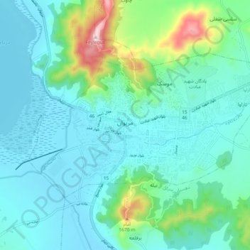
Name: Marivan topographic map, elevation, terrain.
Location: Marivan, بخش مرکزی, Marivan County, Kurdistan Province, Iran (35.49974 46.14065 35.54248 46.23159)
Average elevation: 4,534 ft
Minimum elevation: 4,213 ft
Maximum elevation: 6,014 ft