
向阳街道 topographic map
Interactive map
Click on the map to display elevation.
About this map
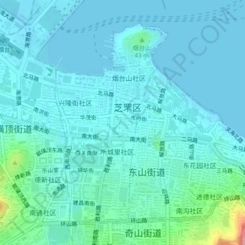
Name: 向阳街道 topographic map, elevation, terrain.
Location: 向阳街道, 芝罘区, 烟台市, 山东省, 264000, 中国 (37.52762 121.38506 37.54968 121.40066)
Average elevation: 56 ft
Minimum elevation: -7 ft
Maximum elevation: 407 ft
Other topographic maps
Click on a map to view its topography, its elevation and its terrain.