
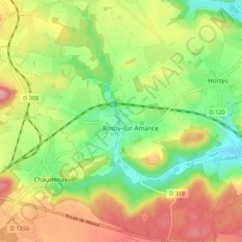
Rosoy-sur-Amance topographic map
Interactive map
Click on the map to display elevation.
About this map
Name: Rosoy-sur-Amance topographic map, elevation, terrain.
Average elevation: 1,030 ft
Minimum elevation: 823 ft
Maximum elevation: 1,276 ft
Other topographic maps
Click on a map to view its topography, its elevation and its terrain.
Montlandon
France > Grand Est > Haute-Marne > Haute-Amance
Montlandon, Haute-Amance, Langres, Haute-Marne, Grand Est, France métropolitaine, 52600, France
Average elevation: 1,135 ft
Rivière au Clos
France > Grand Est > Haute-Marne > Haute-Amance
Rivière au Clos, Troischamps, Haute-Amance, Langres, Haute-Marne, Grand Est, France métropolitaine, 52600, France
Average elevation: 1,050 ft