
定州市 topographic map
Interactive map
Click on the map to display elevation.
About this map
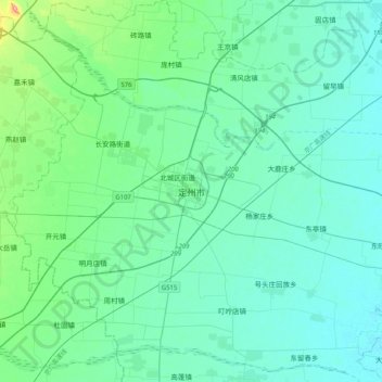
Name: 定州市 topographic map, elevation, terrain.
Location: 定州市, 保定市, 河北省, 中国 (38.35122 114.83700 38.67122 115.15700)
Average elevation: 184 ft
Minimum elevation: 115 ft
Maximum elevation: 627 ft
河北省中部偏西,平均海拔43.6米,年均日照2611.9小时,年均气温为12.4℃,年际间气温差异不大。年均地面温度为19.6℃;年均降水量为503.2毫米。全年多起东北风。
Other topographic maps
Click on a map to view its topography, its elevation and its terrain.