
Mittelhorn topographic map
Interactive map
Click on the map to display elevation.
About this map
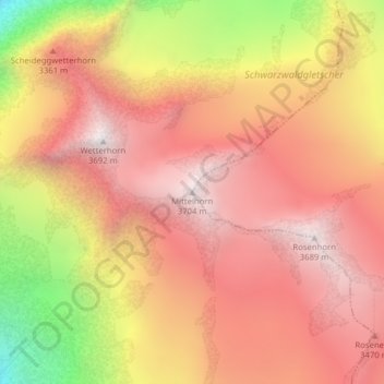
Name: Mittelhorn topographic map, elevation, terrain.
Average elevation: 10,325 ft
Minimum elevation: 7,116 ft
Maximum elevation: 12,096 ft
Other topographic maps
Click on a map to view its topography, its elevation and its terrain.
Kleines Schreckhorn
Svizzera > Berna > Grindelwald
Kleines Schreckhorn, Grindelwald, Verwaltungskreis Interlaken-Oberhasli, Verwaltungsregion Oberland, Berna, Svizzera
Average elevation: 9,449 ft
Mönch
Svizzera > Berna > Grindelwald
Mönch, Grindelwald, Verwaltungskreis Interlaken-Oberhasli, Verwaltungsregion Oberland, Berna, 3801, Svizzera
Average elevation: 11,138 ft
Bärglistock
Svizzera > Berna > Grindelwald
Bärglistock, Grindelwald, Verwaltungskreis Interlaken-Oberhasli, Verwaltungsregion Oberland, Berna, Svizzera
Average elevation: 10,430 ft
Wetterhorn
Svizzera > Berna > Grindelwald
Wetterhorn, Grindelwald, Verwaltungskreis Interlaken-Oberhasli, Verwaltungsregion Oberland, Berna, Svizzera
Average elevation: 9,396 ft