
Lindell topographic map
Interactive map
Click on the map to display elevation.
About this map
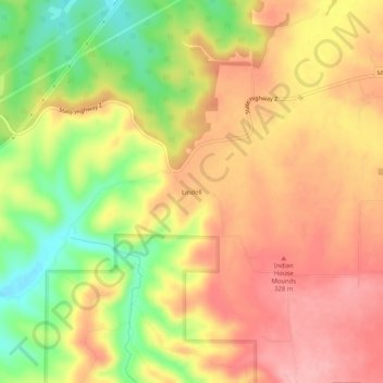
Name: Lindell topographic map, elevation, terrain.
Location: Lindell, Maries County, Missouri, United States of America (38.15088 -91.81183 38.19088 -91.77183)
Average elevation: 965 ft
Minimum elevation: 732 ft
Maximum elevation: 1,125 ft