
王坛镇 topographic map
Interactive map
Click on the map to display elevation.
About this map
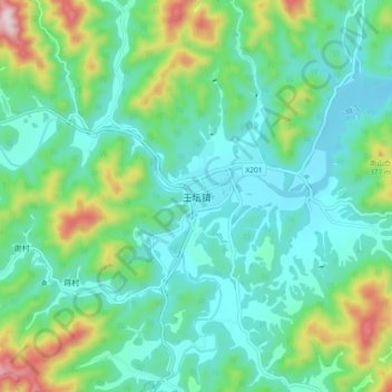
Name: 王坛镇 topographic map, elevation, terrain.
Location: 王坛镇, 绍兴市, 浙江省, 中国 (29.74683 120.63182 29.82683 120.71182)
Average elevation: 505 ft
Minimum elevation: 85 ft
Maximum elevation: 1,801 ft
Other topographic maps
Click on a map to view its topography, its elevation and its terrain.