
Tlalpan topographic map
Interactive map
Click on the map to display elevation.
About this map
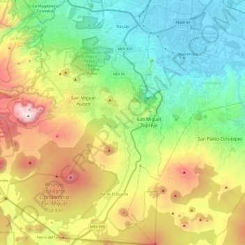
Name: Tlalpan topographic map, elevation, terrain.
Location: Tlalpan, Ciudad de México, México (19.08938 -99.31625 19.31226 -99.10093)
Average elevation: 9,295 ft
Minimum elevation: 7,316 ft
Maximum elevation: 12,897 ft
De este modo, el clima varía de templado subhúmedo en la parte Norte a semifrío subhúmedo conforme aumenta la altitud hasta tornarse semifrío húmedo en las partes más altas.
Other topographic maps
Click on a map to view its topography, its elevation and its terrain.
Ciudad Universitaria
Ciudad Universitaria, Ciudad de México, 04360, México
Average elevation: 7,549 ft