
Laufersweiler topographic map
Interactive map
Click on the map to display elevation.
About this map
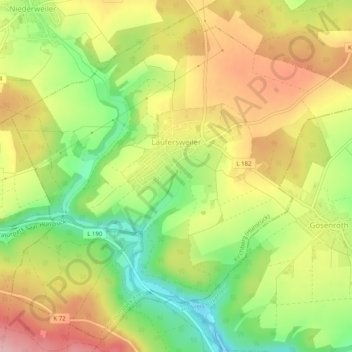
Name: Laufersweiler topographic map, elevation, terrain.
Average elevation: 1,411 ft
Minimum elevation: 1,145 ft
Maximum elevation: 1,670 ft
Other topographic maps
Click on a map to view its topography, its elevation and its terrain.
Horn
Deutschland > Rheinland-Pfalz > Rhein-Hunsrück-Kreis
Horn, Simmern-Rheinböllen, Rhein-Hunsrück-Kreis, Rheinland-Pfalz, Deutschland
Average elevation: 1,473 ft
Boppard
Deutschland > Rheinland-Pfalz > Rhein-Hunsrück-Kreis > Boppard
Boppard, Rhein-Hunsrück-Kreis, Rheinland-Pfalz, 56154, Deutschland
Average elevation: 1,007 ft