
Siddheshwar Dam topographic map
Interactive map
Click on the map to display elevation.
About this map
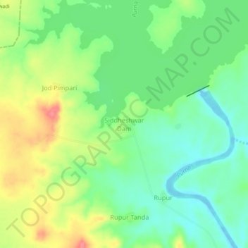
Name: Siddheshwar Dam topographic map, elevation, terrain.
Location: Siddheshwar Dam, Aundha (Nagnath), Hingoli, Maharashtra, India (19.56518 76.92300 19.60518 76.96300)
Average elevation: 1,365 ft
Minimum elevation: 1,266 ft
Maximum elevation: 1,512 ft