
Las Huertas de Cansa topographic map
Interactive map
Click on the map to display elevation.
About this map
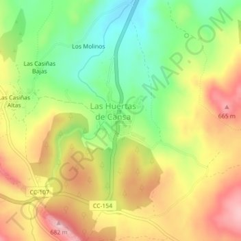
Name: Las Huertas de Cansa topographic map, elevation, terrain.
Location: Las Huertas de Cansa, Cáceres, Estrémadure, Espagne (39.34761 -7.27652 39.35425 -7.27080)
Average elevation: 1,867 ft
Minimum elevation: 1,562 ft
Maximum elevation: 2,175 ft