
Burton and Dalby topographic map
Interactive map
Click on the map to display elevation.
About this map
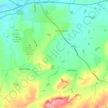
Name: Burton and Dalby topographic map, elevation, terrain.
Average elevation: 367 ft
Minimum elevation: 220 ft
Maximum elevation: 689 ft
Other topographic maps
Click on a map to view its topography, its elevation and its terrain.
Beacon Hill
United Kingdom > England > Melton
Beacon Hill, Melton, Leicestershire, East Midlands, England, NG13 0GT, United Kingdom
Average elevation: 118 ft