
招贤镇 topographic map
Interactive map
Click on the map to display elevation.
About this map
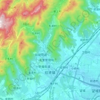
Name: 招贤镇 topographic map, elevation, terrain.
Location: 招贤镇, 湾里管理局, 新建区, 霞麦村, 新建区, 南昌市, 江西省, 中国 (28.66580 115.68772 28.77549 115.77598)
Average elevation: 614 ft
Minimum elevation: 62 ft
Maximum elevation: 2,641 ft