
Mazıköy topographic map
Interactive map
Click on the map to display elevation.
About this map
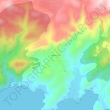
Name: Mazıköy topographic map, elevation, terrain.
Location: Mazıköy, Bodrum, Muğla, Aegean Region, Turkey (36.99389 27.71974 37.03389 27.75974)
Average elevation: 630 ft
Minimum elevation: -3 ft
Maximum elevation: 1,611 ft
Other topographic maps
Click on a map to view its topography, its elevation and its terrain.
Turgutreis
Turgutreis, Bodrum, Muğla, Aegean Region, 48960, Turkey
Average elevation: 131 ft