
Apuya topographic map
Interactive map
Click on the map to display elevation.
About this map
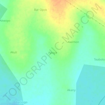
Name: Apuya topographic map, elevation, terrain.
Location: Apuya, Amach, District de Lira, Northern Region, Ouganda (2.03714 33.02197 2.07714 33.06197)
Average elevation: 3,445 ft
Minimum elevation: 3,402 ft
Maximum elevation: 3,510 ft