
Westtown topographic map
Interactive map
Click on the map to display elevation.
About this map
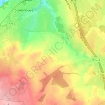
Name: Westtown topographic map, elevation, terrain.
Location: Westtown, South Lanarkshire, Scotland, ML9 3PS, United Kingdom (55.66198 -3.98205 55.70198 -3.94205)
Average elevation: 584 ft
Minimum elevation: 344 ft
Maximum elevation: 794 ft