
San Martin topographic map
Interactive map
Click on the map to display elevation.
About this map
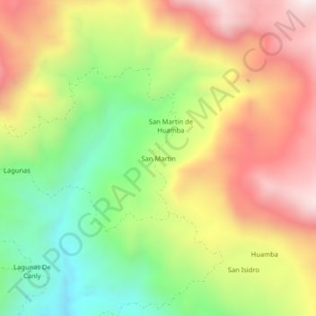
Name: San Martin topographic map, elevation, terrain.
Location: San Martin, Distrito de Ayabaca, Ayabaca, Piura, Perú (-4.72694 -79.55091 -4.68694 -79.51091)
Average elevation: 7,530 ft
Minimum elevation: 5,942 ft
Maximum elevation: 9,209 ft