
Litchfield Municipality topographic map
Interactive map
Click on the map to display elevation.
About this map
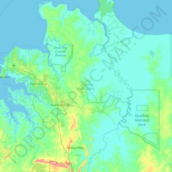
Name: Litchfield Municipality topographic map, elevation, terrain.
Location: Litchfield Municipality, Northern Territory, Australia (-12.86189 130.85898 -12.14268 131.39673)
Average elevation: 49 ft
Minimum elevation: -7 ft
Maximum elevation: 472 ft
Other topographic maps
Click on a map to view its topography, its elevation and its terrain.
Mutitjulu
Australia > Northern Territory > Mutitjulu
Mutitjulu, Northern Territory, Australia
Average elevation: 1,745 ft
Mount Sanford
Australia > Northern Territory
Mount Sanford, Victoria-Daly Region, Northern Territory, Australia
Average elevation: 820 ft