
North Cooking Lake topographic map
Interactive map
Click on the map to display elevation.
About this map
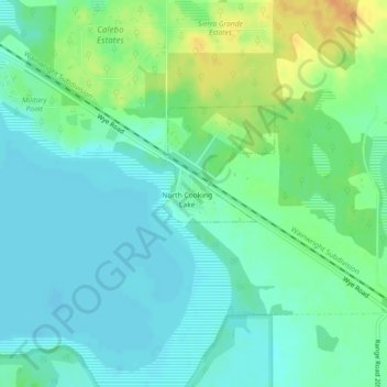
Name: North Cooking Lake topographic map, elevation, terrain.
Location: North Cooking Lake, Comté de Strathcona, Alberta, Canada (53.46055 -112.95176 53.46451 -112.94084)
Average elevation: 2,444 ft
Minimum elevation: 2,408 ft
Maximum elevation: 2,520 ft