
Río Negro topographic map
Interactive map
Click on the map to display elevation.
About this map
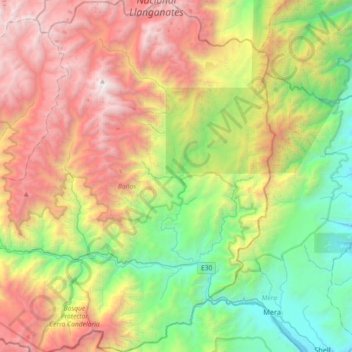
Name: Río Negro topographic map, elevation, terrain.
Location: Río Negro, Baños, Tungurahua, 180302, Ecuador (-1.50199 -78.34322 -1.14052 -78.11020)
Average elevation: 7,943 ft
Minimum elevation: 3,271 ft
Maximum elevation: 14,708 ft
Other topographic maps
Click on a map to view its topography, its elevation and its terrain.