
Dubreuilville topographic map
Interactive map
Click on the map to display elevation.
About this map
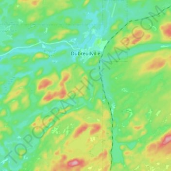
Name: Dubreuilville topographic map, elevation, terrain.
Location: Dubreuilville, Algoma District, Ontario, P0S 1B0, Canada (48.27923 -84.66612 48.38044 -84.51395)
Average elevation: 1,211 ft
Minimum elevation: 1,053 ft
Maximum elevation: 1,581 ft