
Berkararlyk etraby topographic map
Interactive map
Click on the map to display elevation.
About this map
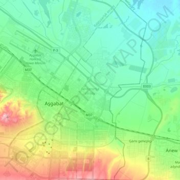
Name: Berkararlyk etraby topographic map, elevation, terrain.
Location: Berkararlyk etraby, Ashgabat, Turkmenistan (37.87754 58.38480 38.02485 58.47864)
Average elevation: 755 ft
Minimum elevation: 545 ft
Maximum elevation: 1,306 ft
Other topographic maps
Click on a map to view its topography, its elevation and its terrain.