
Waldorf topographic map
Click on the map to display elevation.
About this map
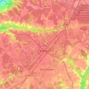
Name: Waldorf topographic map, elevation, terrain.
Location: Waldorf, Charles County, Maryland, United States (38.54351 -76.99845 38.66129 -76.84199)
Average elevation: 187 ft
Minimum elevation: 46 ft
Maximum elevation: 240 ft
Charles County trails, hiking, mountain biking, running and outdoor activities
Other topographic maps
Click on a map to view its topography, its elevation and its terrain.