
Make a donation
Gear up for your next adventure:
As an Amazon Associate, this site earns from qualifying purchases at no extra cost to you.
Pordenone / Pordenon topographic map
Click on the map to display elevation.
Make a donation
Gear up for your next adventure:
As an Amazon Associate, this site earns from qualifying purchases at no extra cost to you.
About this map
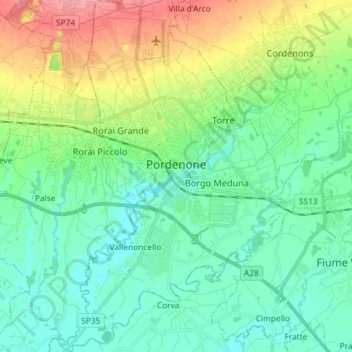
Name: Pordenone / Pordenon topographic map, elevation, terrain.
Location: Pordenone / Pordenon, Friuli – Venezia Giulia, 33170, Italy (45.90231 12.61072 46.00329 12.70263)
Average elevation: 108 ft
Minimum elevation: 30 ft
Maximum elevation: 295 ft
Make a donation
Gear up for your next adventure:
As an Amazon Associate, this site earns from qualifying purchases at no extra cost to you.
Other topographic maps
Click on a map to view its topography, its elevation and its terrain.
Erto / Nert
Italy > Friuli – Venezia Giulia > Pordenone / Pordenon > Erto e Casso
Average elevation: 3,648 ft
Bannia / Banìe
Italy > Friuli – Venezia Giulia > Pordenone / Pordenon > Fiume Veneto
Average elevation: 69 ft