Geolocate

Quillayute topographic map

Click on the map to display elevation.

About this map

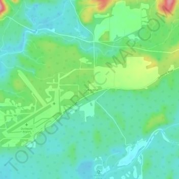
Name: Quillayute topographic map, elevation, terrain.

Location: Quillayute, Clallam County, Washington, United States (47.92313 -124.56243 47.96313 -124.52243)

Average elevation: 151 ft

Minimum elevation: 30 ft

Maximum elevation: 466 ft

Clallam County trails, hiking, mountain biking, running and outdoor activities

Gear up for your next adventure:

🎒Day Hiking Backpack - Lightweight backpack perfect for day trips and outdoor adventures
🌧️Backpack Rain Cover - Keep gear dry in wet weather
📷Action Camera - Capture your outdoor adventures in HD
🧢Sun Protection Hats - Wide-brimmed and UPF-rated hats for high-altitude sun safety
🛡️Insect Repellent - Protection against bugs during outdoor activities

As an Amazon Associate, this site earns from qualifying purchases at no extra cost to you.