
Lake Jipe topographic map
Interactive map
Click on the map to display elevation.
About this map
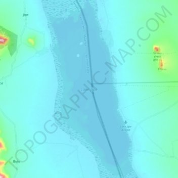
Name: Lake Jipe topographic map, elevation, terrain.
Location: Lake Jipe, Taita Taveta, Coastal Kenya, Kenia (-3.65666 37.74255 -3.55291 37.78435)
Average elevation: 2,398 ft
Minimum elevation: 2,313 ft
Maximum elevation: 3,038 ft
Other topographic maps
Click on a map to view its topography, its elevation and its terrain.
Tsavo West National Park
Tsavo West National Park, A23, Taita Taveta, Kenia
Average elevation: 3,182 ft