Geolocate

Map Ta Phut topographic map

Click on the map to display elevation.

About this map
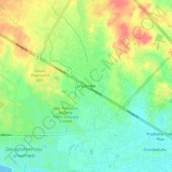
Name: Map Ta Phut topographic map, elevation, terrain.

Location: Map Ta Phut, Map Ta Phut City Municipality, Mueang Rayong District, Rayong Province, 21150, Thailand (12.55365 101.00791 12.87365 101.32791)

Average elevation: 115 ft

Minimum elevation: -10 ft

Maximum elevation: 1,322 ft

Other topographic maps

Click on a map to view its topography, its elevation and its terrain.

Rayong

Thailand > Mueang Rayong District

Average elevation: 20 ft

Gear up for your next adventure:

📦Dry Bags Set - Waterproof storage for electronics and clothes
🚁Photography Drones - Capture stunning aerial views of landforms and topography
🎒Waterproof Dry Bags - Keep your electronics and maps dry inside your pack
🔥Fast-Boil Camping Stoves - Efficient cooking systems for quick trail meals
🌄Hiking Binoculars - Compact binoculars for scenic views and trail spotting

As an Amazon Associate, this site earns from qualifying purchases at no extra cost to you.