
La Caillerie topographic map
Interactive map
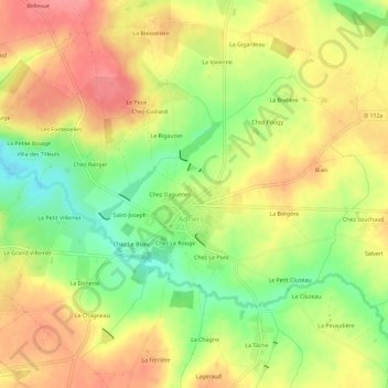
Click on the map to display elevation.
About this map
Name: La Caillerie topographic map, elevation, terrain.
Average elevation: 636 ft
Minimum elevation: 489 ft
Maximum elevation: 755 ft
Other topographic maps
Click on a map to view its topography, its elevation and its terrain.
Chez Le Rouge
France > Nouvelle-Aquitaine > Vienne > Adriers
Chez Le Rouge, Adriers, Montmorillon, Vienne, Nouvelle-Aquitaine, Metropolitan France, 86430, France
Average elevation: 640 ft
La Porte
France > Nouvelle-Aquitaine > Vienne > Adriers
La Porte, Adriers, Montmorillon, Vienne, Nouvelle-Aquitaine, Metropolitan France, 86430, France
Average elevation: 636 ft