
Afernakou topographic map
Interactive map
Click on the map to display elevation.
About this map
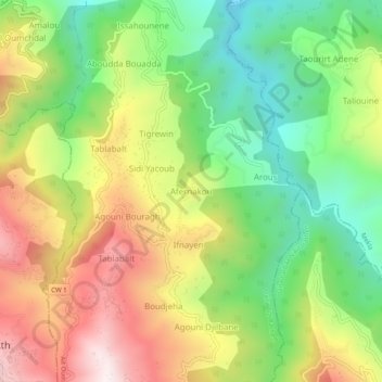
Name: Afernakou topographic map, elevation, terrain.
Average elevation: 1,716 ft
Minimum elevation: 545 ft
Maximum elevation: 3,186 ft
Other topographic maps
Click on a map to view its topography, its elevation and its terrain.
Taddart Oufella
Algérie > Tizi Ouzou > Daïra Tizi Rached > Aït Oumalou
Taddart Oufella, Aït Oumalou, Daïra Tizi Rached, Tizi Ouzou, 15002, Algérie
Average elevation: 2,490 ft
Tablabalt
Algérie > Tizi Ouzou > Daïra Tizi Rached > Aït Oumalou
Tablabalt, Aït Oumalou, Daïra Tizi Rached, Tizi Ouzou, 15051, Algérie
Average elevation: 2,133 ft