
Bougi topographic map
Interactive map
Click on the map to display elevation.
About this map
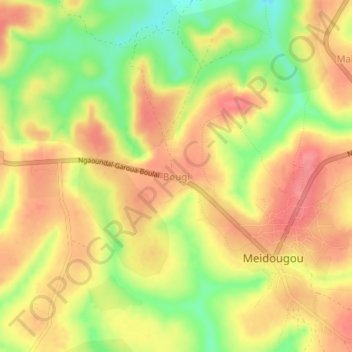
Name: Bougi topographic map, elevation, terrain.
Location: Bougi, Meiganga, Mbéré, Région de l'Adamaoua, Cameroun (6.40857 14.18720 6.44857 14.22720)
Average elevation: 3,363 ft
Minimum elevation: 3,215 ft
Maximum elevation: 3,458 ft
Other topographic maps
Click on a map to view its topography, its elevation and its terrain.
Ngazi
Cameroun > Région de l'Adamaoua > Mbéré > Meiganga
Ngazi, Meiganga, Mbéré, Région de l'Adamaoua, Cameroun
Average elevation: 3,238 ft