
Beef topographic map
Interactive map
Click on the map to display elevation.
About this map
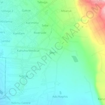
Name: Beef topographic map, elevation, terrain.
Location: Beef, Nakuru, Kenia (-0.30735 36.16393 -0.26735 36.20393)
Average elevation: 6,417 ft
Minimum elevation: 6,270 ft
Maximum elevation: 6,854 ft
Other topographic maps
Click on a map to view its topography, its elevation and its terrain.
Nakuru
Kenia > Nakuru > Nakuru West
Nakuru, Nakuru West, Nakuru, Rift Valley, 20100, Kenia
Average elevation: 6,302 ft
Nakuru National Park
Nakuru National Park, Woodley Road, Nakuru, Kenia
Average elevation: 6,237 ft