
Thank you for supporting this site ❤️
Make a donation
Make a donation
Gear up for your next adventure:
As an Amazon Associate, this site earns from qualifying purchases at no extra cost to you.
Colón topographic map
Click on the map to display elevation.
Thank you for supporting this site ❤️
Make a donation
Make a donation
Gear up for your next adventure:
As an Amazon Associate, this site earns from qualifying purchases at no extra cost to you.
About this map
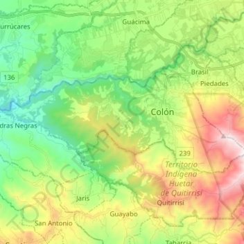
Name: Colón topographic map, elevation, terrain.
Location: Colón, Mora, San Jose Province, 10701, Costa Rica (9.88402 -84.32499 9.93542 -84.19843)
Average elevation: 3,054 ft
Minimum elevation: 1,503 ft
Maximum elevation: 6,266 ft
Thank you for supporting this site ❤️
Make a donation
Make a donation
Gear up for your next adventure:
As an Amazon Associate, this site earns from qualifying purchases at no extra cost to you.