Geolocate

Katni topographic map

Click on the map to display elevation.

About this map
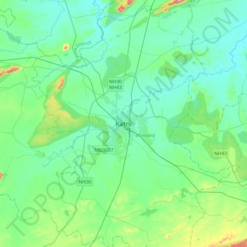
Name: Katni topographic map, elevation, terrain.

Location: Katni, Murwara Tahsil, Katni, Madhya Pradesh, 483500, India (23.67396 80.23246 23.99396 80.55246)

Average elevation: 1,309 ft

Minimum elevation: 1,158 ft

Maximum elevation: 2,001 ft

Gear up for your next adventure:

👟Men's Trail Runners - Lightweight footwear for fast-paced exploration and light hiking
🧯Emergency Survival Kit - All‑in‑one survival essentials for the backcountry
🏕️Family Camping Gear - Essentials for group camping trips
🪶Survival Guide Book - Expert advice for emergency preparedness
🌧️Backpack Rain Cover - Keep gear dry in wet weather

As an Amazon Associate, this site earns from qualifying purchases at no extra cost to you.