
Thank you for supporting this site ❤️
Make a donation
Make a donation
Gear up for your next adventure:
As an Amazon Associate, this site earns from qualifying purchases at no extra cost to you.
Cugy topographic map
Click on the map to display elevation.
Thank you for supporting this site ❤️
Make a donation
Make a donation
Gear up for your next adventure:
As an Amazon Associate, this site earns from qualifying purchases at no extra cost to you.
About this map
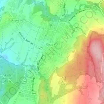
Name: Cugy topographic map, elevation, terrain.
Location: Cugy, District du Gros-de-Vaud, Vaud, 1053, Switzerland (46.56986 6.62918 46.59470 6.65699)
Average elevation: 2,375 ft
Minimum elevation: 2,126 ft
Maximum elevation: 2,723 ft
Thank you for supporting this site ❤️
Make a donation
Make a donation
Gear up for your next adventure:
As an Amazon Associate, this site earns from qualifying purchases at no extra cost to you.