Geolocate

Popondetta topographic map

Click on the map to display elevation.

About this map

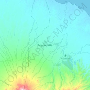
Name: Popondetta topographic map, elevation, terrain.

Location: Popondetta, Oro, Southern Region, Papua New Guinea (-8.92674 148.07751 -8.60674 148.39751)

Average elevation: 594 ft

Minimum elevation: 0 ft

Maximum elevation: 4,859 ft

Other topographic maps

Click on a map to view its topography, its elevation and its terrain.

Eora Creek

Papua New Guinea > Oro

Average elevation: 5,659 ft

Gear up for your next adventure:

📷Action Camera - Capture your outdoor adventures in HD
Solar GPS Watches - Advanced multisport watches with built-in topographic maps
👖Convertible Hiking Pants - Versatile zip-off pants for changing altitudes and temperatures
🖼️Topo Map Wall Art - Decorative topographic prints of famous peaks and regions
🧴Hand Sanitizer - Keep hands clean while hiking

As an Amazon Associate, this site earns from qualifying purchases at no extra cost to you.