
Fleuran topographic map
Interactive map
Click on the map to display elevation.
About this map
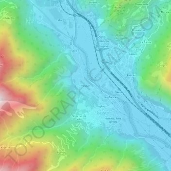
Name: Fleuran topographic map, elevation, terrain.
Location: Fleuran, Favà, Issogne, Valle d'Aosta, 11029, Italia (45.64058 7.65879 45.68058 7.69879)
Average elevation: 2,244 ft
Minimum elevation: 1,148 ft
Maximum elevation: 5,525 ft