
Leigh topographic map
Click on the map to display elevation.
About this map
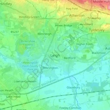
Name: Leigh topographic map, elevation, terrain.
Average elevation: 112 ft
Minimum elevation: 39 ft
Maximum elevation: 361 ft
Other topographic maps
Click on a map to view its topography, its elevation and its terrain.
Leigh Branch (Leeds & Liverpool Canal)
United Kingdom > England > Wigan > Abram
Average elevation: 141 ft