Geolocate

Shiloh topographic map

Click on the map to display elevation.

About this map

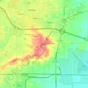
Name: Shiloh topographic map, elevation, terrain.

Location: Shiloh, Saint Clair County, Illinois, 62269, United States (38.52144 -89.93732 38.60144 -89.85732)

Average elevation: 518 ft

Minimum elevation: 413 ft

Maximum elevation: 673 ft

Saint Clair County trails, hiking, mountain biking, running and outdoor activities

Gear up for your next adventure:

🕶️GPS Smartphone Mount - Secure mount for phone navigation
🛌Ultralight Sleeping Bags - Compact down bags for cold nights in the wilderness
🧯Portable Fire Pit - Compact fire pit for camping spots
🎒Gear Packing Cubes - Organize your backpack efficiently
🧯Emergency Survival Kit - All‑in‑one survival essentials for the backcountry

As an Amazon Associate, this site earns from qualifying purchases at no extra cost to you.