
Oued Ouirane topographic map
Interactive map
Click on the map to display elevation.
About this map
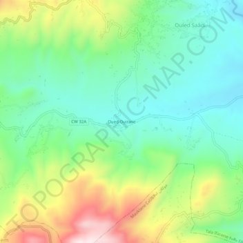
Name: Oued Ouirane topographic map, elevation, terrain.
Location: Oued Ouirane, Tala Ifacene, Daïra Maouklane, Sétif, Algérie (36.43353 5.10660 36.47353 5.14660)
Average elevation: 2,762 ft
Minimum elevation: 2,139 ft
Maximum elevation: 4,012 ft