
Folkston topographic map
Interactive map
Click on the map to display elevation.
About this map
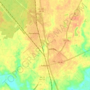
Name: Folkston topographic map, elevation, terrain.
Location: Folkston, Charlton County, Georgia, United States (30.81084 -82.03558 30.88357 -81.97327)
Average elevation: 79 ft
Minimum elevation: 0 ft
Maximum elevation: 115 ft
Other topographic maps
Click on a map to view its topography, its elevation and its terrain.
Okefenokee National Wildlife Refuge
United States > Georgia > Charlton County
Okefenokee National Wildlife Refuge, Charlton County, Georgia, United States
Average elevation: 115 ft