Geolocate

Campdevànol topographic map

Click on the map to display elevation.

About this map
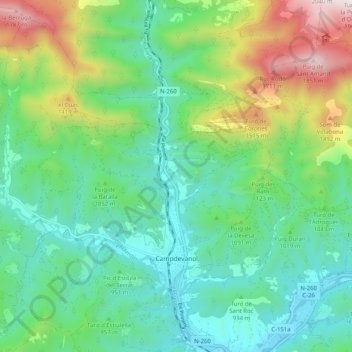
Name: Campdevànol topographic map, elevation, terrain.

Location: Campdevànol, Ripollès, Girona, Catalonia, 17530, Spain (42.20667 2.09384 42.27438 2.19512)

Average elevation: 3,366 ft

Minimum elevation: 2,247 ft

Maximum elevation: 6,194 ft

Other topographic maps

Click on a map to view its topography, its elevation and its terrain.

Puigmal d'Err

Spain > Catalonia > Ripollès > Queralbs

Average elevation: 8,435 ft

Gear up for your next adventure:

🧦Hiking Socks - Comfortable socks to prevent blisters on long hikes
🎒Waterproof Dry Bags - Keep your electronics and maps dry inside your pack
🛶Inflatable Kayak - Portable kayak for rivers, lakes, and expeditions
🌡️Portable Weather Meter - Track weather conditions on the trail
🛡️Bear Spray Outdoor - Protection in bear country hikes

As an Amazon Associate, this site earns from qualifying purchases at no extra cost to you.