
Moira topographic map
Interactive map
Click on the map to display elevation.
About this map
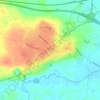
Name: Moira topographic map, elevation, terrain.
Location: Moira, Comté de Down, Ulster, Irlande du Nord, Royaume-Uni (54.47244 -6.24240 54.48536 -6.21305)
Average elevation: 161 ft
Minimum elevation: 98 ft
Maximum elevation: 249 ft
Other topographic maps
Click on a map to view its topography, its elevation and its terrain.
Clare
Royaume-Uni > Irlande du Nord > Comté de Down > Moira
Clare, Moira, Comté de Down, Ulster, Irlande du Nord, Royaume-Uni
Average elevation: 144 ft